
Hale Luana Evacuation Map
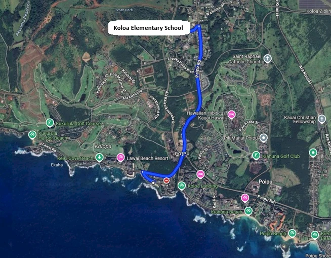

Hale Luana enjoys and ideal oceanfront location overlooking Kauai's Baby Beach. Because of the close proximity to the coastline, this home is located in the tsunami evacuation zone. In the rare instance a tsunami evacuation is declared, please check local media and the county website: www.kauai.gov for listings of open shelters. The County of Kauai has these official potential shelters list, with Koloa Elementary School being the closest option.
Driving Directions to Koloa Elementary School from Hale Luana (total distance 1.8 miles):
- Turn Left - Out of the driveway onto Hoona Rd toward Lawai Rd
- Turn Right - Onto Lawai Rd
- Continue Straight - At the traffic circle onto Poipu Rd
- Turn Left - Onto Paanau Rd. Koloa Elementary School will be on the right.